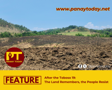

TAPAZ, Capiz – Members of the indigenous tribe Tumandok (Panay-Bukidnon) of Central Panay were shocked on mid-October when portions of Sitio Laugan in the village of Aglinab in this town were found with cracks while some areas suffered from land depression that affected their farm lands and homes.
In an interview with Teresita “Nay Angging” Gayas, a local leader in the sitio, she said that 41 houses were already affected.
The Tumandoks conducted their own investigation last October 29 and measured cracks and coverage of the incident.
PHOTOS: Tumandok initial investigation
“Cracks were found on the floors and outside of our houses. Our vegetable garden was also torn just like a piece of paper,” said Nay Angging in their local dialect.
The Tumandok leader added that some houses have already tilted while some are about to fall to the ground.
In their investigation, the cracks were as wide as 8 feet, with depth of 4 feet and run as long as 100 feet.
“There are a total of 64 households in this sitio. Right now, we were told to relocate but we have no place to transfer yet,” she said worriedly.
The Tumandoks estimated the coverage of damage to 10 hectares.
Relocation and evacuation
The local municipality of Tapaz, by recommendation of the Philippine Institute of Volcanology and Seismology (PHIVOLCS), the Mines and Geosciences Bureau (MGB), and the provincial and municipal disaster risk reduction and management offices (PDRRMO and MDRRMO), has ordered evacuation of affected families.
Tapaz Mayor Roberto Palomar also advised the Tumandoks to keep into safety their important documents and useful things at home, farm inputs and animals. He also told them to gather materials that will be needed for their relocation.
But Tumandoks have not yet evacuated the sitio citing there is no place for relocation.
Instead, they made use of their traditional makeshift houses kurob located behind hills where there is no crack yet and which they considered safe.
Kurobs are normally made during typhoons as shelter to avoid strong winds.
Earthquake and heavy rains
In the month of September, two tremors were felt in the area, according to the locals.
“Before the cracks and depression, we remember to have felt earthquakes on September 15 and days after that.”
But on August 15, a 5.4-magnitude earthquake already hit the island of Panay. The magnitude of the quake is 5.1, depth of 48 kilometers and the epicenter located at Valderrama of Antique town.
The tremor was generated by the active West Panay fault line that caused the strongest quake in Panay in 1948.
Sitio Laugan is estimated to be just 15 kilometers from the active known fault.
Heavy rains also came pouring down in the hinterlands of Central Panay starting October 16, they said.
“The rain is non-stop since October 16. Sometimes on daytime, sometimes at night.”
Highly susceptible to landslides
Tapaz municipality is considered “highly prone to landslides” according to the Department of Environment and Natural Resources’ (DENR) MGB report.
According to MGB, areas classified as “highly and moderately susceptible to landslide” in the geohazard assessment and mapping should be vacated especially during rainy season.
The MGB data have also classified 564 villages that are highly susceptible while 550 villages are moderately susceptible to landslides.
NIA drillings
The Tumandoks suspected that drilling activities near their sitio may have also triggered the movements.
The National Irrigation Administration (NIA) is set to erect another mega dam this time in the Pan-ay river of Capiz. The dam area is said to be at Sitio Garo of Acunia village, several kilometers away from Laugan.
Since January, the NIA has conducted several drilling activities at Sitio Garo where an accident has already occurred last year when a backhoe overturned due to land erosion that severely hurt the driver.
The drilling activity is part of the feasibility study of the NIA for the said dam.
Another mega dam of NIA along the Jalaur River has faced delay in construction for three years now due to strong oppositions by the Tumandoks.
Not fit for dams, mining
“It is clear now for us that indeed our area is not fit for mega dams and mining. We also don’t want our lands to be submerged in water that will cost us our lives and livelihood,” said TUMANDUK organization chairperson Marevic Aguirre.
Aguirre’s village Lahug which she also serves as captain, adjacent to Aglinab, remains the only village to have not approved of the feasibility study by the NIA.
“The situation in Laugan could just be a tip of an iceberg. When the drillings continue and the dam is erected, many more communities shall suffer the same,” Aguirre said.
“The entry of mining activities will also greatly affect our lands. Mining itself will directly wipe out our villages and will contaminate our water sources which we enjoy in abundance, fresh and for free,” she added.
In-depth study
Though the PHIVOLCS, MGB, PDRRMO and MDRRMO have already conducted initial investigations, a more in-depth and comprehensive study is still needed to assess the range and impact of the incident, the group suggested.
“Initially the PHIVOLCS told us that our sitio could turn into a “hidden lake” in the mountains,” said Nay Angging.
“In which case, we want to know exactly what will happen to our sitio and is this just an isolated case or other villages will also face the same danger,” she added.
The Tumandoks will be having dialogues with various agencies for the conduct of these studies and will seek assistance in time of relocation.
The Tumandoks of Panay are the largest indigenous group largely located along major Jalaur and Pan-ay rivers. (John Ian S. Alenciaga | panaytoday.net)